
Duration: Day trip
Province: Chiang Mai
Distance: App. 85 km
Google Maps: Map 1 Map 2 Map 3
Accommodation: Not needed
Sights: Tiger Kingdom, Bai Orchid & Butterfly Farm, Mae Sa Monkey Center, Mae Sa river & waterfall, Mae Sa Elephant Camp, Queen Sirikit Botanical Garden, various viewpoints, Samoeng Forest
This is one of Chiang Mai’s most popular day tours. Although only around 85 km long, the Mae Sa Loop can easily take up the whole day because of the many attractions and interesting places along the way. If you plan to visit them all, it’s best to start off early in the morning. The pictures of this tour were taken in January 2009 and November 2016.
We begin this motorbike tour from the Chang Pueak Gate (white elephant gate), on the northern side of the city moat and drive north on Route 107 (Map 1).
After about 15 km, we arrive to Mae Rim district, where we can top up with petrol, if necessary. There is a couple of petrol stations on the right hand side of the road, just about 600 meters before the turn off into the Mae Sa valley.
Turn left onto Route 1096 and drive into the valley.

Route 1096 is a really nice country road and in a good condition, but the traffic volume on first few kilometers is quite high, as there are many smaller and bigger busses, that bring tourists from the city to the valley.
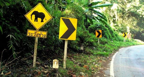
The lovely road leads through a very scenic region with forested mountains and little villages. Watch out for elephants along the road, as there are a couple of elephant camps nearby.

Pretty Bougainvillea in different colors grow by the roadside.
You will pass several, popular tourist attractions such as Tiger Kingdom, Bai Orchid & Butterfly farm, Siam Insect Zoo and the Mae Rim Monkey School.
After about 5 kilometers appears the small Mae Sa river on the left hand side and Route 1096 follows alongside the river for quite a while.

The small Mae Sa river, as seen from the roadside. Hard to see and hidden among the trees in the background is a little suspension bridge.
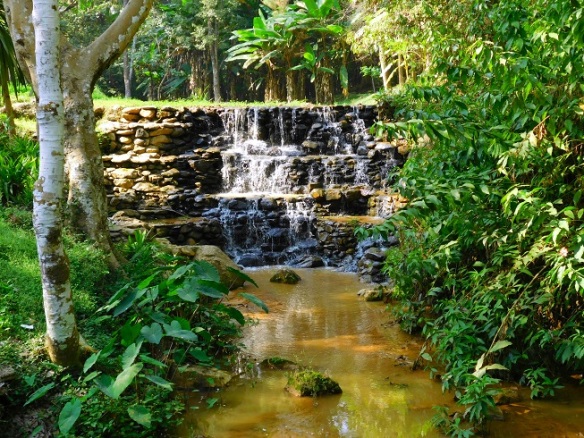
Located a bit further upstream and on the left hand side, is the rather small Mae Sa waterfall (Map 2).

The small river has numerous little waterfalls along this section of road. It looks actually more like several rapids, than a waterfall, but nevertheless a nice enough place to stop by.

Dense vegetation and tall jungle trees flank the road on both sides. The Mae Sa valley is one of the most beautiful areas close to the city.
Shortly after the waterfall comes the Mae Sa Elephant Camp, also on the left hand side. There is a dozen of similar elephant camps, all within an hour-drive from Chiang Mai.
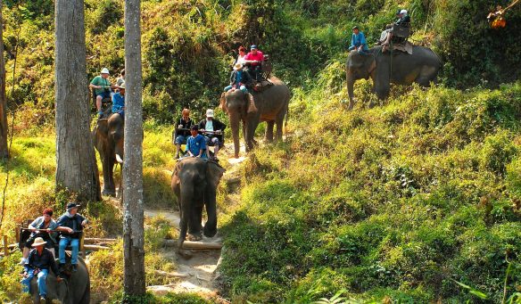
A group of tourists is riding on elephants. Elephant riding is one of the most popular tourist activities in Thailand and not only children enjoy these elephant rides.
Keep going on Route 1096.

Once you are past the numerous touristic places, the nice road becomes much quieter.
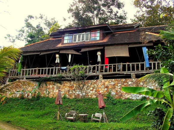
Along the route are many small restaurants or cafes and most of them are situated right by the river.

This restaurant features a nicely created entrance with tropical plants and a small wooden bridge across the river. The big leafed plant on the right hand side of the entrance is a Dieffenbachia, a very popular houseplant in north America and Europe.

Pretty Blackwood trees in full blossom, as seen in a bend on Route 1096. These nice trees can be seen along many roads in Thailand.
After around 11 kilometers, you will reach the wide entrance to the wonderful Queen Sirikit Botanical Garden, which is located on the left hand side as well (Map 2).
The botanical garden was the first international standard botanical garden established in Thailand. It was given the name of her Majesty Queen Sirikit of Thailand in 1994, to honor her dedication towards the conservation of the genetic diversity of plants

A remarkably tall tree stands next to the road and marks the entrance to the very nice botanical garden.

The lower trunk of the tall tree is adorned with large, multi-colored butterflies.
If you like to visit the botanical garden, which is highly recommendable, you will have to pay an entrance fee.
Unfortunately the botanical garden follows too, the widespread dual pricing policy. The fee for Thais is only 50 Baht, while foreigners pay 100. But compared to some national parks, where foreigners pay up to 400 Baht, the botanical garden seems to be worth the inflated price.
The botanical garden is situated in a large, park-like mountain setting and features many differently themed gardens, a nature trail and a large greenhouse complex. A really nice place to explore.
You can either book a guided tour of the garden, or you can drive around by yourself. A small tarmac road leads in a wide circle through the garden and connects all important places.
In early 2015, a new attraction was added to the garden. The magnificent canopy walkway.

About half way up and on the right hand side is a small building, which serves as an entrance to the canopy walkway.

The walkway is constructed from steel and glass. It extends about 20 meters above the ground and has a total length of over 400 meters.


Some impressions of the canopy walkway can be seen in the above pictures.
It is definitely a very interesting walk and lets you experience the forest from a completely new angle. The entire walk takes only about half an hour to complete. Check it out.

An observation platform is located at the end of the walkway and offers nice views over parts of the garden, the forest and the valley.
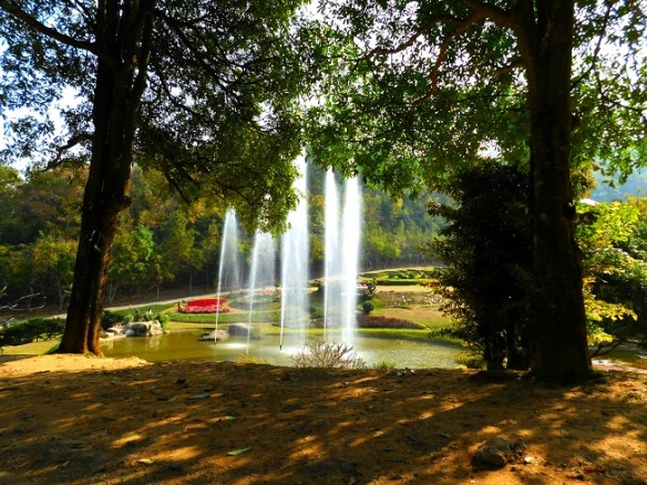
High water jets shoot up from a pond. The lovely pond is surrounded by nice flowerbeds, lawns and many trees.
A large section on the eastern side of the garden comprises a nature trail and a collection of interesting trees from all over the world.
Located further up and just below the mountaintop is the large glass house complex, which consists of more than 10 greenhouses.

There is a tropical rainforest house, an arid house, an aquatic house, a limestone house, a carnivorous house, a medicinal house, a water-lily and lotus house, an aroid house, a bromeliad house, a variegated plants house and of course an orchid house.

This huge, three storey glass house is called the jungle house, or tropical rainforest house.

The jungle house is home to many different tropical rainforest plants and showcases an authentic piece of dense, tropical jungle including a nice little waterfall and a fish pond.

A lady slipper orchid. This orchid is native to the jungles of southeast Asia and its beautiful flower can last for several months. The botanical name of the plant is Paphiopedilum.
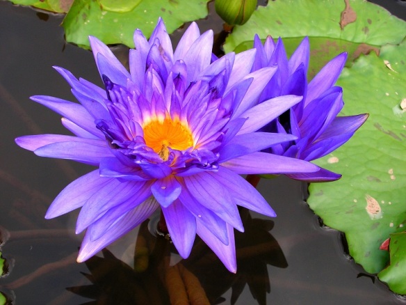
Water lilies or Nymphaeaceae in many different colors can be seen in the aquatic house. The above picture shows a purple water-lily of the type Nymphaea nouchali.
From the greenhouse complex, the road leads downhill.
A nice looking, man-made waterfall is situated along the way on the western side of the garden.
Close to the exit of the botanical garden are a couple of greenhouses, which contain a wide range of beautiful orchids.

Pink nun’s hood orchids, also known as swamp lilies, as seen in one of the orchid houses. While most orchids grow on trees, the nun’s hood orchids grow on the ground.


The above pictures show some of the amazing orchids, that can be seen in this section of the botanical garden.
If you like orchids, you will love this place. The botanical garden has hundreds of different orchids in many shapes, sizes and colors.
To explore all areas of the botanical garden can take several hours, or perhaps the whole day. If interested, you should come back here on another day. Queen Sirikit Botanical Garden is open every day and definitely worthwhile a visit.
Keep going on Route 1096. The road meanders through little villages and a very scenic surroundings

A section of Route 1096, as seen in Ban Pong Yaeng village.
Should you get hungry or thirsty, there are many little restaurants and cafes all along the route.

Once you are through Ban Pong Yaeng, the road starts to climb steadily and the temperature is getting notably cooler, the higher you get.

A beautiful and good smelling pine forest occupies the top of the next hill. These kind of pines are called Khasi pines and can be found all over Asia.
When you are on the other side of the hill, you will notice a small, octagonal pavilion on the right hand side.

A group of motorbike riders are making a break at the pavilion. The nice and open-sided building is a popular resting place on the Mae Sa loop.

The pavilion offers a fantastic view across the vast Samoeng forest and the endless forest covered mountains.

View of the little lookout pavilion, as seen from the next road bend.
Keep going on Route 1096.

The splendid road leads now downhill into the Samoeng valley and pleases every motorbike rider with a series of nicely flowing bends.
After a few kilometers, Route 1096 ends and meets Route 1269.
Turn left onto Route 1269 and follow it to the southeast.
Route 1269 is the main connection between the city of Chiang Mai and the district of Samoeng.
Soon after the turn off, the road makes a very steep climb and leaves the Samoeng valley.

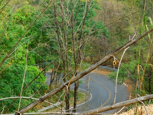
The road disappears into a dense forest and is followed by a series of very tight and steep hairpin turns.

Several short straights always end in a tight hairpin turn, while the road leads up the steep slope.
One of the many hairpin turns, seen from the next road level.
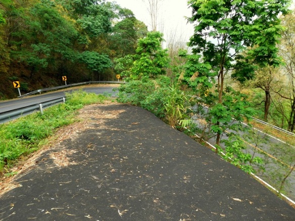
Due to the many hairpin turns, Route 1269 is able to overcome a great height, on a short distance.

A look down, goes over three levels of road. The above picture shows nicely, how steep this section of Route 1269 really is.
The last hairpin turn, before you finally reach the top, is one of the tightest and steepest.

Right after the steep uphill drive ends, parts of Route 1269 are covered with old leaves and the road can be slippery. So watch out.

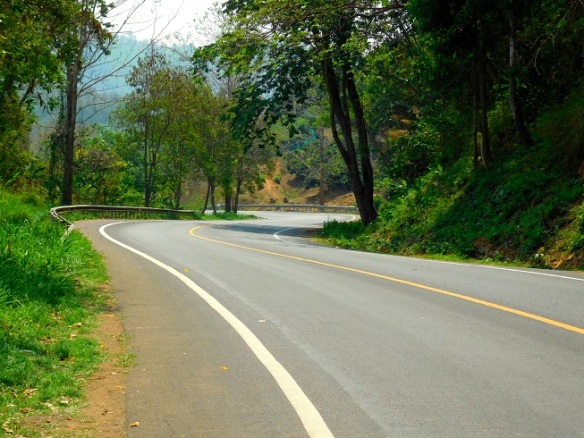
On the way down into the next valley. The lovely road reminds a little bit of a roller coaster ride.

An idyllic and very secluded valley with only a dozen houses and a small temple, lies between Samoeng and Pan Pong.
It takes less than a minute, to drive through the entire valley, before the road leads uphill again.

Once you are across the next hilltop, Route 1269 leads steadily downhill and into the Ban Pong valley.
A combination of bends, on the way to Ban Pong. Similar as the road in the Mae Sa valley, Route 1269 is ideal for a nice motorbike ride.

Green fields in the Ban Pong valley. Countless fine views are gliding past while you are riding along on this scenic road.
Small chairs and a table stand in front of a rustic looking cafe. There are numerous small restaurants and cafes in the valley.
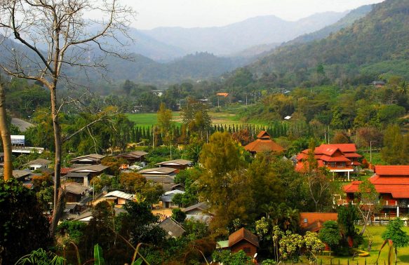
Parts of Ban Pong, as seen from Route 1269.
Ban Pong is only a 30 minute drive away from Chiang Mai. It is located at an elevation of 500 meters and offers a cool climate all year round. The village has a population of about 5.000 people and there are numerous resorts, which are mainly booked by Thai tourists.

A very impressive gate stands open and a drive way leads into a large private property. Getting closer to Chiang Mai, you will drive past a number of very expensive looking properties.

These immaculately cut trees are standing by the roadside and mark the entrance to a hotel close to Ban Pong.

Two simple bridges sit amidst dense vegetation and lead over an irrigation canal in the rural countryside.
Keep going on Route 1269, while you approach the last part of the Mae Sa loop.
You will finally reach the end of Route 1269 and reach the traffic lights at the intersection with Route 121.
Drive straight onto Route 121.
Keep going for about 2 km, until the very next intersection.
Turn left onto Route 108 and follow it for some 6 km.
Route 108 will take you straight back to the southern side of the old city moat in Chiang Mai.
The Mae Sa loop is done by many bikers and that is not without a reason. This lovely motorbike tour leads through a beautiful and rural surrounding, with many hills and large forests. As most tourist attractions are located in the Mae Rim area, there are still plenty of empty road sections, that are ideal for motorbiking.
